Klicken oder tippen Sie hier, um die interaktive Anwendung zu nutzen

Interaktiv

2016/2017

image

23.01.2016

It wasn’t always the East – where Germany votes for the far-right

The German federal election takes place this September. This interactive shows which parts of Germany have voted for the far-right since reunification, and subjects widely held beliefs regarding the far-right parties and their voters to a fact check. (graphic/application in German only)

image

19.09.2016

Berlin election map 2016

The interactive map for the 2016 election of the Berlin house of representatives includes every single vote in the 1779 poll stations. Specific electoral behavious is interpreted in additional maps, e.g. election outcomes around refugee housing or the location of the most non-voters. (graphic/application in German only)

image

26.09.2016

Berlin Marathon 2016 in time-lapse

The interactive graphic shows the route of the 43rd Berlin Marathon as an animated time lapse on a map. Each runner is represented by an animated dot. Users can filter the dots and find out how runners from their country or city have performed compared to the rest of the runners. (graphic/application in German only)

image

10.05.2016

Satellite Check: These are Germany's greenest cities

Many major German cities claim to have a lot of green areas. The interactive map shows for the first time how green Germany really is and ranks German cities accordingly. The Berliner Morgenpost analysed satellite images from the past ten years detecting planted areas (NDVI method) creating an entirely new map. (graphic/application in German only)

image

21.11.2016

Berlin‘s coalition agreement - line by line

Never has a coalition agreement in Berlin filled more pages. We highlighted and annotated the most important paragraphs. (graphic/application in German only)

image

16.11.2016

Trump’s border wall across the globe

US President Donald Trump is planning a wall on the border with Mexico. On our interactive map users can move the border pattern to anywhere across the globe. (graphic/application in German only)

image

27.10.2016

These are the 160 newly elected members of the Berlin parliament

The interactive graphic features all newly elected Berlin MPs and allows users to filter information: Which MP lives closeby your own home? Which state/country did they move from? Who has the most parliamentary experience? (graphic/application in German only)

image

13.12.2016

Baby boom in Berlin

For many years Prenzlauer Berg was Berlin’s baby boom central. Now other districts are closing in - most of all Friedrichshain. (graphic/application in German only)

image

08.09.2016

These candidates live farthest away from their voters

Berlin Election 2016: The application shows where the 652 direct candidates live and for which constituency they stand. For some it’s a long way to work. (graphic/application in German only)

The Interactive Team

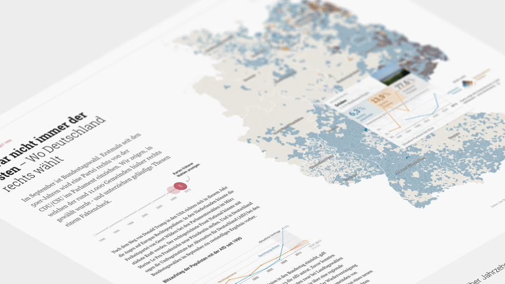
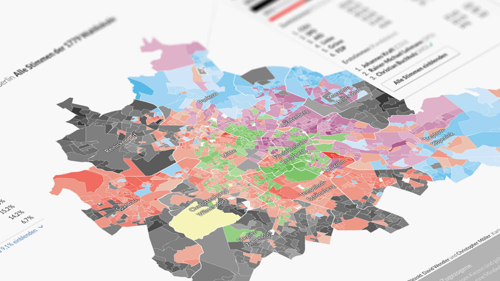
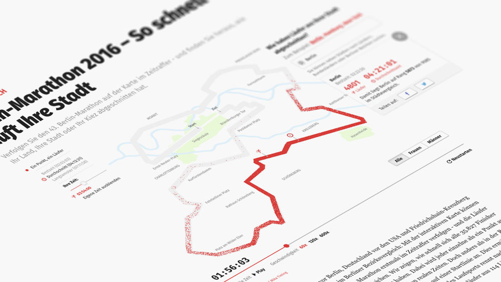
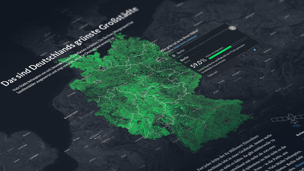
The Berliner Morgenpost Interactive Team regularly publishes applications, graphics, maps and storytelling formats. Marie-Louise Timcke, Julius Tröger, André Pätzold, Moritz Klack, Christopher Möller and David Wendler find news in data and experiment with forms of presentation. This is a selection of publications from 2016 and early 2017. More projects can be found here.